
Services
RAMP services are flow eligible and qualify for 150% assessment credit in Saskatchewan. We partnered with Heli-Recon to deliver our services.
Exploration Service Plans
Greenfield Basic Service
• Little or no geophysical data
• Priority target area determined by the client
Greenfield Full Service
• Little or no geophysical data
• RAMP geological review
• RAMP recommends priority targets to the client
Advanced Geology Basic Service
• An advanced data set exists
• Priority target area is determined by the client
Advanced Geology Full Service
• An advanced data set exists
• RAMP data review
• RAMP recommends priority targets to the client
Reporting Plans
Silver plan
• RAMP provides client with maps and data summary
Gold plan
• RAMP provides a summary report with priority target list for ground truthing, along with maps and data summary
Case Studies
About
RAMP Geological Services Inc was founded by a group of expert geological, geophysical, and management consultants for the implementation of our proprietary RAMP-HD airborne radiometric system & methodology.
Our goal is to compress costs and timelines for critical mineral discovery in Canada. Delineating in high-definition geophysical anomalies that will distinguish high priority targets from low priority targets. Exploration companies can then prioritize ground truthing to get costly and time-consuming boots on the ground to the highest priority targets.
Introducing RAMP-HD
RAMP-HD is designed to quickly pin-point and fingerprint in real-time, individual occurrences within and between anomalies only broadly defined by the conventional geological, geochemical or conventional airborne/satellite surveys, achieving resolution not possible with the latter.
Whatever your initial, grass-roots targeting methodology, RAMP-HD cost-effectively reduces time and effort required for ground follow-up by providing precise locations of the best exposures, ranked according to your exploration model. Crews can now concentrate on best logistics to access and sample highest potential targets, rather than spending an entire summer defining and sampling many low potential anomalies.
This is especially beneficial where traversing is difficult due to dense tree growth, deadfall in burnt areas, rugged terrain, swamps, rivers or lakes. And, because RAMP deployment avoids ground disturbance, no permit is required!
RAMP delineates anomaly extent in all directions, providing shape to the anomaly that can be readily correlated with known or unmapped geological features of interest including mineralized strata, intrusive phases, critical mineral exposures and structurally controlled alteration. Our on-board geophysical expert guides the RAMP helicopter pilot based on real-time results, to fully characterize the anomalous area footprint and all local hot spots within that area.
Now, dozens of anomalies can be evaluated in a few hours instead of weeks or months using ground crews. RAMP results include anomaly maps, tables of GPS coordinates for all hot spots, description of radioactive elements present and interpretation of potential economic minerals of interest.
News
Stay up to date with our latest updates.
Team
Meet our team of geological and geophysical experts.
Rob Shives, B.Sc., P.Geo.
President & Co-Founder
Rob Shives obtained his B.Sc. from Carleton University in 1979. He spent five years in the private sector successfully exploring northern Saskatchewan for uranium in the eastern Athabasca Basin and gold in the La Ronge gold belt, and for gold in Ontario. He then joined the Geological Survey of Canada’s Radiation Geophysics Section, planning, conducting and applying airborne magnetic and gamma ray spectrometric surveys across Canada and elsewhere, to exploration of a wide variety of commodities (not just uranium). He has published hundreds of Open Files, formal papers, poster abstracts and produced several workshop manuals describing interpretation and application to mineral exploration, environmental issues, geological mapping and emergency response.
Rob became Head of the Section during the last decade with GSC, leaving in 2007 to more rigorously apply the method, as a consultant, under the name GamX Inc. Rob continues to deliver undergrad and Masters level short courses relating to gamma ray spectrometric methods, data and interpretation and to industry at various geological conference workshops.
Through GamX Inc, he offers training, workshops, survey design, data interpretation and application to various industrial clients. He is also Vice President of Exploration for EnGold Mines Ltd, actively exploring for copper-gold and related deposits within British Columbia’s Quesnel Trough.
Rob is a member of the Association of Professional Engineers and Geoscientists of Saskatchewan (APEGS), the Association of Professional Engineers and Geoscientists of the Province of British Columbia (EGBC) and the Prospectors & Developers Association of Canada (PDAC).
Bill Dynes, B.Sc., P.Geo.
Advisor & Co-Founder
Mr Dynes is a member in good standing with the Association of Professional Engineers and Geoscientists of Alberta (APEGA) and is the President of Sierra Geological Corp. With 38 years of world wide experience in mining and mineral exploration, he was involved in the discovery of the Canada’s Gaucho Kue diamond deposit, which was recently estimated to be one of the world’s 10 largest diamond mines ( currently producing ~6 million carats/year).
Mr. Dynes research on diamond deposits initiated the formation of the University of British Colombia’s Diamond Exploration Lab. He was a founding shareholder of Rio Alto Mining Ltd that was sold to Tahoe Resources Inc for $1.2 billion in 2015. His most recent work includes involvement in the exploration, discovery and delineation of several frac deposits including Alberta’s currently producing Sanguido mine ( ~ 600,000 tons /year).
Malcolm MacDougall, M.A.Sc., P.Geo.
VP Technology
Malcolm earned his B.Sc. degree in geophysics from the University of Calgary in 2017 and his M.A.Sc. degree in geological engineering from Queen’s University in 2019. He has over five years of experience working in different roles in the natural resource industry, servicing various mining projects across Ontario as well as conducting exploration and analysis for resources within Western Canada.
Malcolm has been engaged in the exploration for silica resources, creating resource models and appraisal of identified aggregate deposits. He is competent in digitizing, managing, and working with large-volume geological datasets, particularly among lithological, geophysical and geospatial data. Malcolm has experience processing airborne geophysical data through all stages of the workflow from raw field QA/QC to final map product. He has processed and gridded datasets up to 100,000-line km. Malcolm has also created and managed airborne survey plans for large projects up to 1,000,000-line km used for mineral exploration programs across various regions worldwide.
He has published work on numerical modelling methods and geophysical potential field interpretation, and additionally presented technical material at various academic and industry events across Canada. Malcolm specializes in numerical modelling methods, interpretation of geophysical data and completing technical reports on geological exploration for minerals.
Colette Kenney, P.Eng., M.A.
VP Operations
Colette is a professional mechanical engineer with more than 20 years of achievement in project management and operations in the energy industry. Over the course of her career, she has accepted the challenge of participating in all aspects of project delivery, including engineering, supply chain, project management, project controls, human resources, business development, and IT. At RAMP geological services she ensures our operations run smoothly, by drawing on her diverse cross-functional experience and training in agile project management.
Alliances
RAMP maintains strategic alliances to deliver.
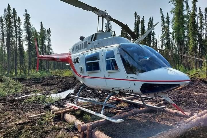
Heli-Recon
Heli-Recon Aerial Support Services is based in the heart of Saskatchewan and has extensive experience in airborne geophysics in the province. Their air and ground crews are highly trained in the aircraft and equipment they operate and RAMP Geological Services are proud to align with their team of aerial experts.